UN
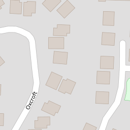
9 Oxcroft
£ 270,000
Description
We don't have a Description for this property.
- Bedrooms
- 3
- Bathrooms
- 0

Leaflet © OpenStreetMap contributors
The heatmap indicates the level of crime in the area. The color of the heatmap indicates the crime severity and recency.
Metrics Year-on-Year
- Average area value
- 308,929.00 £Decreased by 36.39 %
- Average area rental value
- 905.00 £/moDecreased by 34.09 %
- Est rental Yield
- 3.52 %Increased by 3.83 %
- Crime Rate
- 77.00 %Unchanged by 0.00 %
from 485,634.00 £
from 1,373.00 £/mo
from 3.39 %
from 77.00 %
Nearby Schools
| Name | Type | Ofsted | Distance |
|---|---|---|---|
| Acle St Edmund Voluntary Controlled Primary School | Voluntary Controlled School | Good | 0.31 KM |
| (Acle) Marshes Children'S Centre | Children's Centre | 0.52 KM | |
| Acle Academy | Academy Converter | Requires improvement | 1.33 KM |
| Freethorpe Community Primary And Nursery School | Community School | Good | 5.75 KM |
| Fairhaven Church Of England Voluntary Aided Primary School | Voluntary Aided School | Good | 5.92 KM |
Images
Nearby Streets
| Name | Average Price | Average Sqft | Distance |
|---|---|---|---|
| Priory Close | £ 300,000 | 0 | 0.00 KM |
| Glebe Road | £ 0 | 0 | 0.00 KM |
| Primrose Drive | £ 250,000 | 0 | 0.00 KM |
| Calthorpe Close | £ 0 | 0 | 0.00 KM |
| George Lane | £ 435,000 | 0 | 0.00 KM |
Nearby Transport
| Name | NLC | TLC | Distance |
|---|---|---|---|
| Acle | 7286 | ACL | 1.12 KM |
| Lingwood | 7305 | LGD | 7.22 KM |
| Cantley | 7292 | CNY | 8.02 KM |
| Reedham (Norfolk) | 7316 | REE | 8.33 KM |
Nearby Listings
| Address | Price | Type | Score | Distance |
|---|---|---|---|---|
| New Close, Acle, NR13 | £ 335,000 | BUY | Unknown | 0.11 KM |
| Springfield, Acle, Norwich, NR13 | £ 250,000 | BUY | 6 / 10 | 0.12 KM |
| Oxcroft, Acle, Norwich | £ 460,000 | BUY | 6 / 10 | 0.12 KM |
| Old Road, Acle, Norwich, NR13 | £ 395,000 | BUY | Unknown | 0.13 KM |
| Cardington Court, Acle, NR13 | £ 130,000 | BUY | 5 / 10 | 0.20 KM |
Nearby Properties
| Address | Price | Distance |
|---|---|---|
| 21 Oxcroft | £ 340,000 | 0.00 KM |
| 5 Oxcroft | £ 125,000 | 0.00 KM |
| 14 Oxcroft | £ 320,000 | 0.00 KM |
| 27 Oxcroft | £ 200,000 | 0.00 KM |
| 8 Oxcroft | £ 288,000 | 0.00 KM |